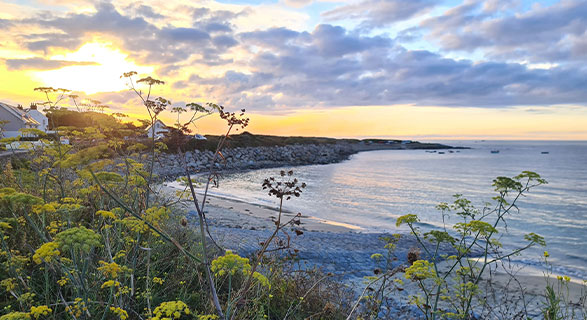
Guernsey Beach Guide
Check Availability
With an area of just 25 square miles, Guernsey offers an impressive 29 miles of coastline to explore on your trip. Each cove, bay, beach, and rockpool have their own perks and special appeal. This Guernsey beach guide will give you a rundown of 22 of the best beaches to visit and tell you a little more about their unique charms, local amenities and a little on how to access the spots; so you can spend less time planning and more time getting out there discovering your new favorite beach and making memories!
Guernsey Beach Guide for Dogs and their Owners
Dogs are welcome! Before we get started it’s important that we highlight a few simple rules that apply on a Guernsey beach holiday for dogs and their humans. Between 1st May and 30th September each year, dogs are not permitted on some beaches, even if on a lead. Other beaches allow dogs at all times of year and you do not need to use a lead. The information for each beach is indicated below. Please also pick up after your dog and prevent them from chasing or disturbing wildlife.
Other than that your four legged friend is free to frolic to their heart’s content. Life is quite simply, a beach.
Safety on Guernsey Beaches
Please be aware that there are no lifeguards on beaches in Guernsey. Take care both on the beach and in the water and always ensure you check the tide times carefully. Guernsey has a very high tidal range and water levels can rise quickly.
Weather and Tides
Before packing your bucket & spade, be sure to check the up to date weather forecast along with today's tide times.. The tidal range is Guernsey is much higher than you may have seen elsewhere, and the tide comes in very quickly in some places. It's important to stay vigilant, don't venture too far out at low tide and always be aware of the closest safe way off the beach.
Scroll to:
South West / South / West / North
North West / South East / East
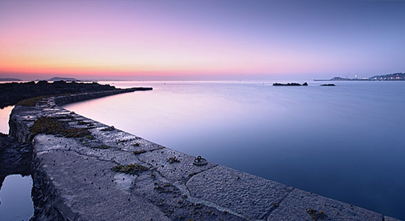
South West
Portelet Bay, Torteval
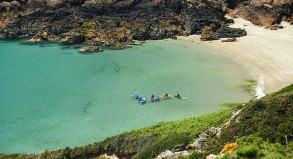
With good sand underfoot, great shallow waters for swimming, and a pleasant small harbour to stroll along, Portelet Bay is a safe and peaceful spot for a day at the beach. Thanks to the beach's southerly orientation, days here are long and bright. A path behind the beach leads on to a picturesque pedestrian-only walk past the lighthouse keepers' cottages to the fort at Pezeries Point, perfect for a romantic stroll!

Dogs
Permitted at all times

Activities
Swimming, bathing
& kayaking

WC
Yes
Rocquaine Bay, Torteval
One of the rare Guernsey shingle beaches, Rocquaine Bay is just shy of a mile north of Portelet Bay, connected by a stunning coastal road. With breathtaking views of the colloquially known Cup and Saucer - otherwise known as Fort Grey, this picturesque bay really is worth a visit during your stay. If you're visiting in July be sure to check out the annual Rocquaine Regatta, a full day and evening of entertainment and activities for people of all ages.
Dogs
Permitted at all times
Activities
Swimming
and bathing
WC
Yes
15 minutes walk away at Portelet
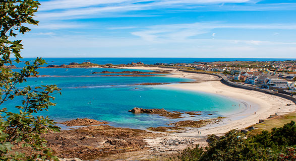
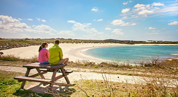
L’Eree, St Peter
L'Eree is a large popular bay, great for the little ones to stretch their legs out and a fantastic place for sandcastle competitions! Like Portelet Bay, L'Eree enjoys long days and is great spot to watch phenomenal sunsets. With easy access from a nearby car park, lots of options to eat lunch or dinner, and excellent ice creams (they always taste best from a van - available all summer) make this a stop on your holiday.

Dogs
Not permitted
between May & Sep
Activities
Swimming, bathing,
snorkelling & rock-pooling
WC
Yes
West
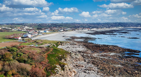
Vazon Bay, Castel
Perfect waves await. Vazon Bay is a second home to surfers, kitesurfers, and bodyboarders alike. Catch our clean waves and enjoy the natural lift back to shore. Not a surfer yet? Vazon is home to Guernsey Surf School - and it is never too late to learn! Not interested in getting in the water after all? This Guernsey beach guide has you covered. This picturesque beach is also a hub to some of Guernsey's best eateries, so go grab a taste of the island and relax.
Dogs
Not permitted
between May & Sep
Activities
Swimming, bathing,
surfing & paddle boarding
WC
Yes
Located next to Richmond Kiosk & Fort Hommet
Cobo Bay, Vale
White sands? Pristine Waters? Blazing sunsets? Check! This lively bay is the perfect location for anyone who's reading this Guernsey Beach Guide and is looking to mix natural serenity with excellent vibes from happy beachgoers. Great for those who want to spend all day at the beach and polish off the evening with some delicious local tipples, and with parking in abundance nearby and wide-open space on the beach, it's also a favourite with young families.
Dogs
Not permitted
between May & Sep
Activities
Swimming, bathing, surfing,
kayaking & paddle boarding
WC
Yes
Next to Cobo Kiosk
Grandes Rocques, La Saline
Another great sunset viewpoint. Just north of the busy Cobo Bay, visit Grandes Rocques for a more relaxed vibe but with all the beauty of the busier bay. With excellent walks around the beach, great swimming in clear waters at all tides, and ample rock pool exploration for when the tide is out this beach is a real gem.
Dogs
Permitted at all times
Activities
Swimming, bathing
& rock-pooling
WC
Yes
Located next to the kiosk
Portinfer, Vale
With great swell, Portinfer is another popular surf spot on the island and the rocky outcrops from the beach make for a truly epic backdrop for when you drop in on the perfect wave. Make sure to check tide times for this beach - the rocks that make this place so spectacular also make it dangerous, so don't go in at low tide or when the tide is on its way up.
Dogs
Permitted at all times
Activities
Swimming, bathing
& surfing
WC
The nearest toilets are
at Port Soif Common
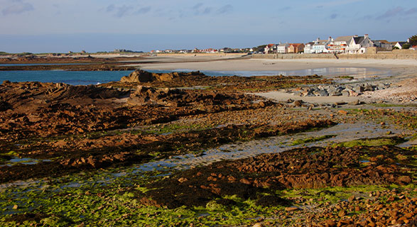
Port Soif, Vale
This horseshoe-shaped picturesque beach offers some shelter from the wind when the weather is a little livelier. Locals flock here on weekends, and if there's anyone who's an arbiter of beach quality it's a Guernsey local! Low tide offers great rock-pooling opportunities and it's a great spot to swim. The beach kiosk sells fabulous ice creams and hot snacks, dig in.
Dogs
Not permitted
between May & Sep
Activities
Swimming
and bathing
WC
Yes
Port Grat, Vale
This stunning horseshoe bay is a brilliant sun-trap with soft white sands and is perfect for a swim at high tide. Port Grat tends to be a little quieter than some of the other beaches on this Guernsey beach guide, so great if you're after some coastal R&R. Up on the headland (a great spot for a stroll too), there is a popular kiosk selling excellent energy-boosting snacks and casual meals.
Dogs
Permitted at all times
Activities
Swimming
and bathing
WC
Yes
Located on Rousse headland
North
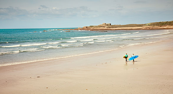
Pembroke and L’Ancresse Bays, Vale
One of the biggest bays on Guernsey, Pembroke and L'Ancresse Bay back directly onto a links-style golf course, but these bays also support a thriving water sports community with excellent windsurfing, surfing, sailing and sea kayaking adventures just waiting for you to dive in. With a water sports centre nearby all that's missing is you!
Dogs
Not permitted
between May & Sep
Activities
Swimming, bathing,
surfing & kayaking
WC
Yes
North West
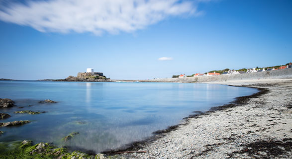
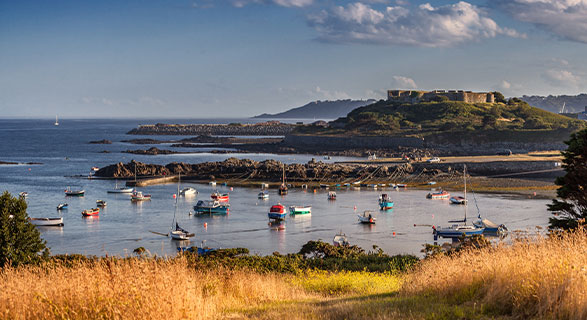
Le Grande Havre, Vale
Grande Havre is a natural harbour with a stunning sandy stretch of beaches including Le Picquerel, Les Ammarreurs Harbour, Rousse, Ladies Bay and Chouet. Grand Havre means "large haven" and it is known for protecting local boats from prevailing southerly winds. A great beach for those who want to learn some local history, Grande Havre was an 18th-century strategic point, defended by two impressive artillery towers, Rousse tower, and Chouet tower, which are definitely worth seeing.
Dogs
Permitted at all times
Activities
Swimming
and bathing
WC
Yes
Located at La Rousse Tower
Chouet Bay and Ladies Bay, Vale
The adjoining bays of Chouet Bay and Ladies Bay abound with soft, fine white sand, good windsurfing conditions, and of course some seriously beautiful views. With a nearby playground and a gently sloping beach with ample paddling opportunities, this is a favourite beach for families.
Dogs
Permitted at all times
Activities
Swimming, bathing
& windsurfing
WC
Yes
At both ends of the bay
East
Belle Greve Bay, St Peter Port
A rocky beach near to St. Peter Port town centre (ideal for those who want the busier hub of the town as their holiday base) Belle Greve offers spectacular views, which stretch as far as some of the other Channel Islands on a clear day. The promenade that runs along the beach make this a brilliant spot for a quiet evening stroll and the colourful boats dotted throughout the water add to the picturesque vibes of this lovely spot.
Dogs
Permitted at all times
Activities
Swimming
and bathing
WC
Yes
At 'halfway' and the QEII Marina
Bordeaux, Vale
A small natural fishing harbour, Bordeaux has two sandy beaches. The ruins of Vale Castle are close by and can be easily reached on foot, for those who want a little history with their beach trip. This walk is a great way to spend the hours waiting for the tide to rise and ideal swimming conditions to return to Bordeaux.
Dogs
Permitted at all times
Activities
Swimming
and bathing
WC
No
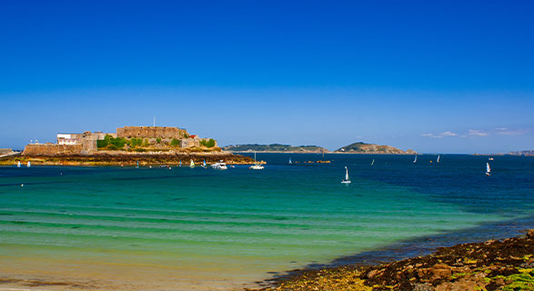
Havelet, St Peter Port
With a mix of sand and shingle, Havelet doesn't have the softest sands but it does offer three tidal pools, ensuring there's always a safe option for those who fancy a dip in the clear sea water. Close to St Peter Port savvy beachgoers while away the hours during high tide at the many excellent eateries while the sea laps up against the harbour wall and return to the beach as the tide retreats.
Dogs
Permitted at all times
Activities
Swimming
and kayaking
WC
Yes
On the Castle Pier
South East
Fermain Bay, St Martin
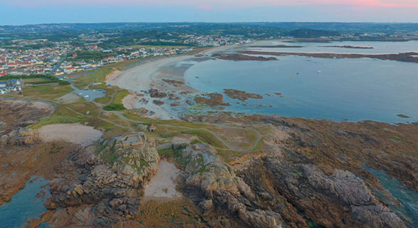
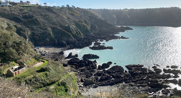
Something to note in this Guernsey beach guide is how the beaches change across the island. Bays in the south are very different from their northern and western equivalents, the bays here are located at the base of cliffs and can't be reached as easily - which is something to keep in mind. Fermain Bay is a rare Guernsey pebbly beach, and the walk down Fermain Hill offers one of the most breathtaking cliff views on the island.
Dogs
Not permitted
between May & Sep
Activities
Swimming
and bathing
WC
Yes
Next to the beach cafe
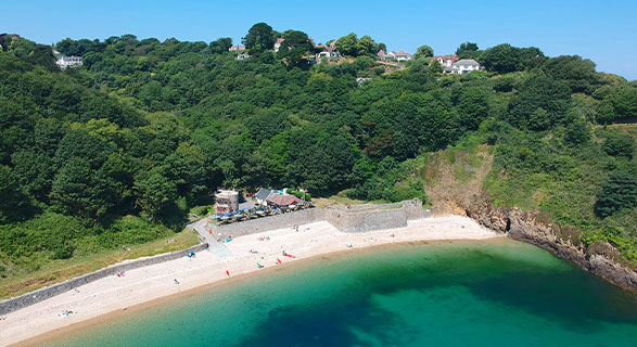
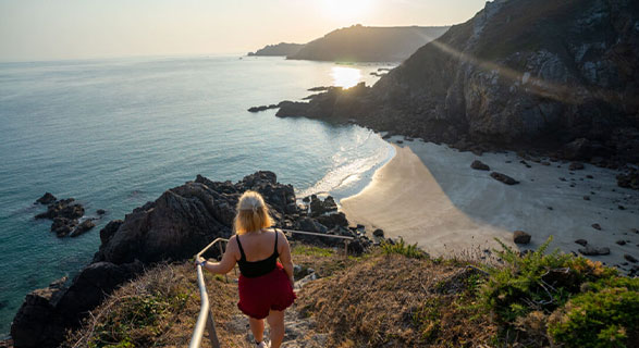
Petit Port, St Martin
Petit by name but massively breath-taking. 400 steep steps down to the beach reward those who make the journey with beauty in abundance. It really is a spectacular beach. This tends to be a quieter spot on the island and you'll often have the place to yourself well into the high season. Enjoy the quiet wonder this beach possesses and bring a camera to capture the views.
Dogs
Permitted at all times
Activities
Swimming
and bathing
WC
The nearest toilets are
at Jerbourg Point
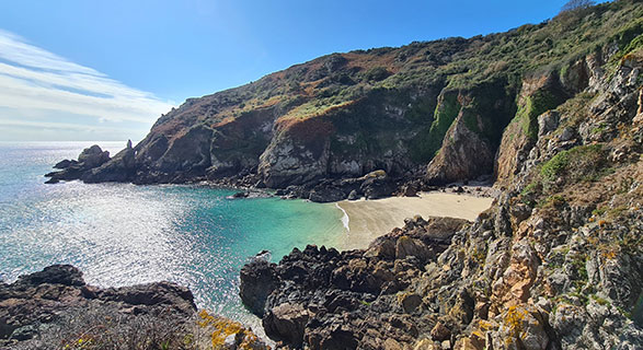
Moulin Huet, St Martin
The French artist Renoir was a fan of Moulin Huet, and we're sure you will be too. This sandy bay is a lush swimming spot and rock-pooling is fantastic at low tide. With a car park just above the bay, it is a short walk to reach the beach, and it is a great spot for everyone.
Dogs
Permitted at all times
Activities
Swimming, bathing
& rock-pooling
WC
Yes
At the top of the footpath
South
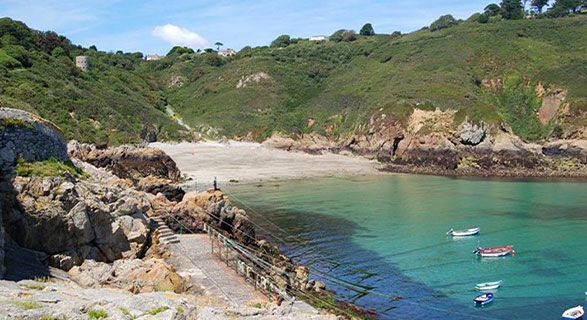
Saints Bay, St Martin
Another one of Guernsey's lesser-visited beaches, what it lacks in footfall does not equate to lesser quality! It really is a beautiful spot, with blue seas and white sands. There is a cliff walk to access the beach, so make sure you bring your provisions down to the water's edge or get those legs warmed up for the repeat journeys back up to the road! A great sheltered area, the waters are calm and ideal for a swim.
Dogs
Permitted at all times
Activities
Swimming
and bathing
WC
Yes
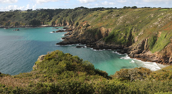
Le Jaonnet Bay, St Martin
This place feels wild. With sweeping cliffs leading down to the blue waters there is a challenging walk to reach this incredible bay. Accessed from the coastal path, La Jaonnet is about half a mile from the car park at Icart Point, and steep steps provide the only access. There is a seat halfway up/down the route, but the journey to this rugged bay is as tough as the bay is remarkable.
Dogs
Permitted at all times
Activities
Swimming
and bathing
WC
The nearest toilets are
at ICart Point
Petit Bot, St Martin
This sheltered sandy bay is embraced by impressive high cliffs. With limited parking nearby make sure to rise early to grab your spot. The descent to the beach (and ascent at the end of the day) is a little challenging, so Petit Bot is more suitable for families with little ones who have firmly found their feet! With a waterfall on the approach to the bay and a quality tearoom, the rewards for getting to Petit Bot early are plentiful, plus the swimming and rock pooling here are top notch.
Dogs
Not permitted
between May & Sep
Activities
Swimming, bathing,
rock-pooling, kayaking & paddle boarding
WC
Yes